
DERRY CITY WALLS AT DAWN
A walk in the footsteps of the Siege of 1689
A mile of stone fortifications, seven gates, massive bastions, a collection of historic cannons and a city whose defenders refused to surrender for 105 days. We climbed onto Derry’s walls before the streets below had even woken up.
From the hotel door to the top of Derry City Walls — one minute and two seconds.
PART 1 — DERRY IS STILL ASLEEP
One minute to four hundred years of history
Derry was still asleep, although not everyone had the morning off. When I stepped out of the hotel, a small street-cleaning vehicle was already working beside the walls, clearing away the remains of Saturday night. Apart from that, there was hardly anyone around — no tour groups, no tourist traffic and no guides waving umbrellas above their heads.
It took me barely a minute to get from the hotel door to the entrance onto the walls. To be precise, the two clips I recorded on the way last for a combined one minute and two seconds, although we can probably blame those extra two seconds on switching the camera on.
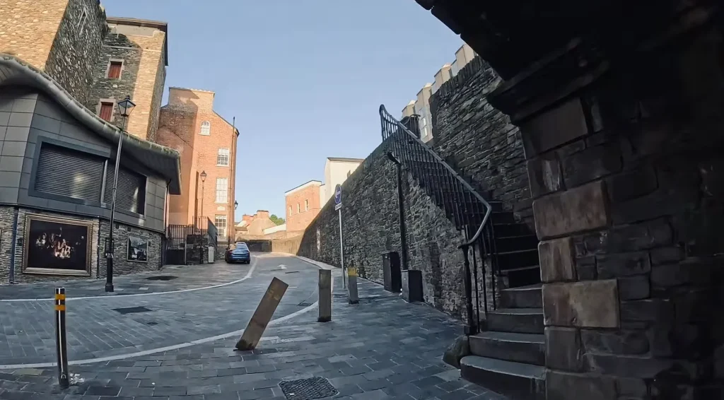
A moment later, I was standing at the stone steps leading to the top of the fortifications.
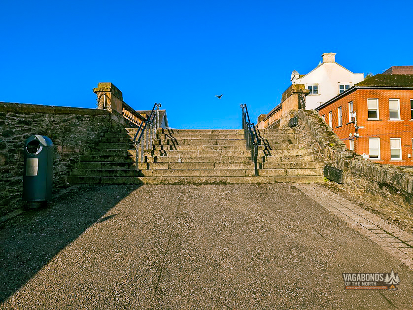
This is one of those places where sightseeing begins without a warm-up. One moment you are walking along an ordinary modern street; a few steps later, you find yourself on a broad promenade running along the top of 17th-century defences.
On one side are the rooftops of the old city, church towers and tightly packed buildings. On the other, the view opens towards the River Foyle, Bogside and the districts beyond.
Ahead of me was a complete circuit: roughly a mile of walls, with gates, bastions and cannons along the way. According to the timestamps on my photographs, the documented circuit took exactly 47 minutes and 57 seconds — from 5:40:48 to 6:28:45.
It was certainly not a brisk walk with a stopwatch running. Every few steps, another view, plaque or detail gave me a reason to stop.
A stone ring around the city
Derry’s walls were built between 1613 and 1618 during the Plantation of Ulster. The project was overseen by The Honourable The Irish Society, established by the London livery companies to organise and finance the new colony.
The fortifications were intended to protect settlers arriving from England and Scotland and to secure a strategically important position above the River Foyle.
This was not the first settlement on the hill. Derry’s history reaches much further back, into the monastic tradition associated with St Columba and the Irish name Doire, meaning “oak grove”.
In the 17th century, however, a new planned city was laid out over this much older landscape. At its heart stood the Diamond, with four main streets radiating towards four gates.
The fortifications are more than a simple stone wall. At their core is an earth rampart faced with stone. The complete circuit is around 1.5 kilometres — roughly one mile — long. The walls rise to about eight metres in places and vary in width from approximately 3.7 metres to more than ten metres.
That width created the broad walkway we can use today, with views both into the old city and across the neighbourhoods that grew beyond its defences.
Originally there were four gates: Shipquay Gate, Ferryquay Gate, Bishop’s Gate and Butcher Gate. Three more — New Gate, Castle Gate and Magazine Gate — were opened later as Derry expanded and traffic increased.
That gives us seven gates today, although only four existed during the Great Siege.
The walls survived repeated attempts to take the city and were never breached by a besieging army. That is the origin of Derry’s old nickname, the Maiden City — a city whose defences were never conquered.
INFOBOX — Derry City Walls in numbers
built: 1613–1618,
complete circuit: approximately 1.5 km / 1 mile,
height: up to approximately 8 metres,
seven gates today, including four original gates,
five surviving original bastions and two gun platforms,
24 surviving cannons restored in 2005,
access to the walls: free.
PART 2 — FIRST STEPS ON THE WALLS
Coward’s Bastion — the beginning of the morning circuit
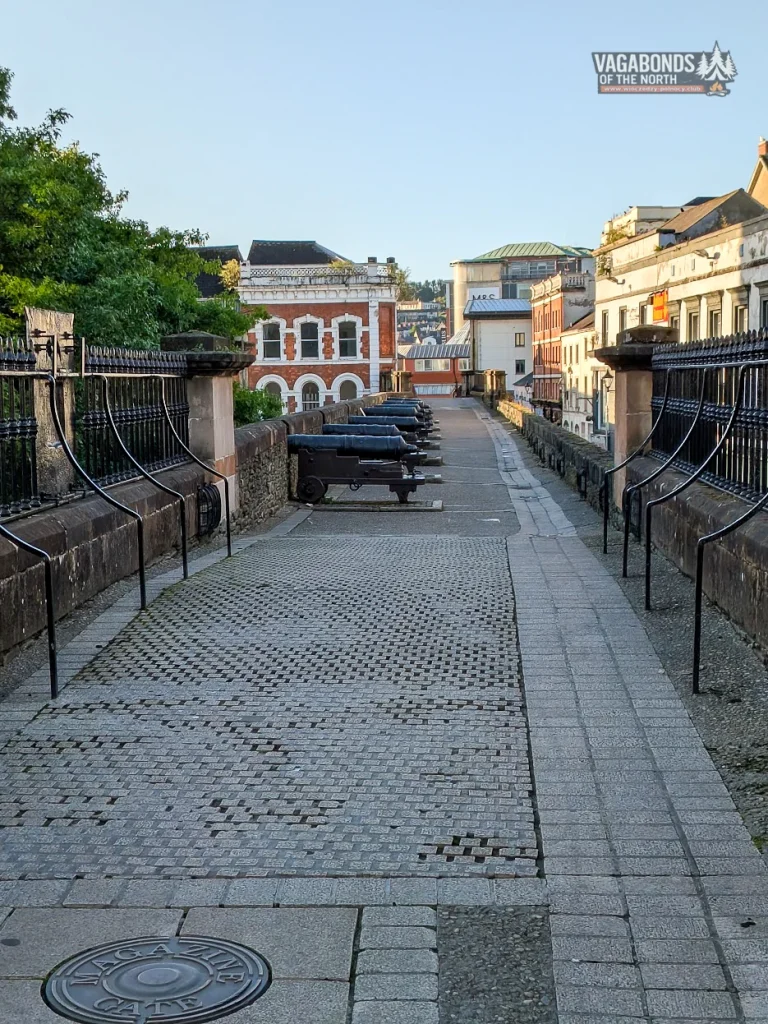
The first named point recorded in my photographs is Coward’s Bastion.
Its name sounds rather unheroic, particularly in a city whose memory is so strongly associated with resistance and the words “No Surrender”. Names like this, however, often grew from local tradition, the function of a particular place or stories whose exact origins can no longer be reconstructed with certainty.
At this hour there was no need to squeeze past groups of visitors. The stone promenade was empty, cannons pointed out above the rooftops and the low morning light picked out every irregularity in the stone.
This was where it first became clear that walking the walls would not simply be a matter of moving from one monument to another. The entire old city lies below your feet, and your route is defined not by streets but by a centuries-old line of defence.
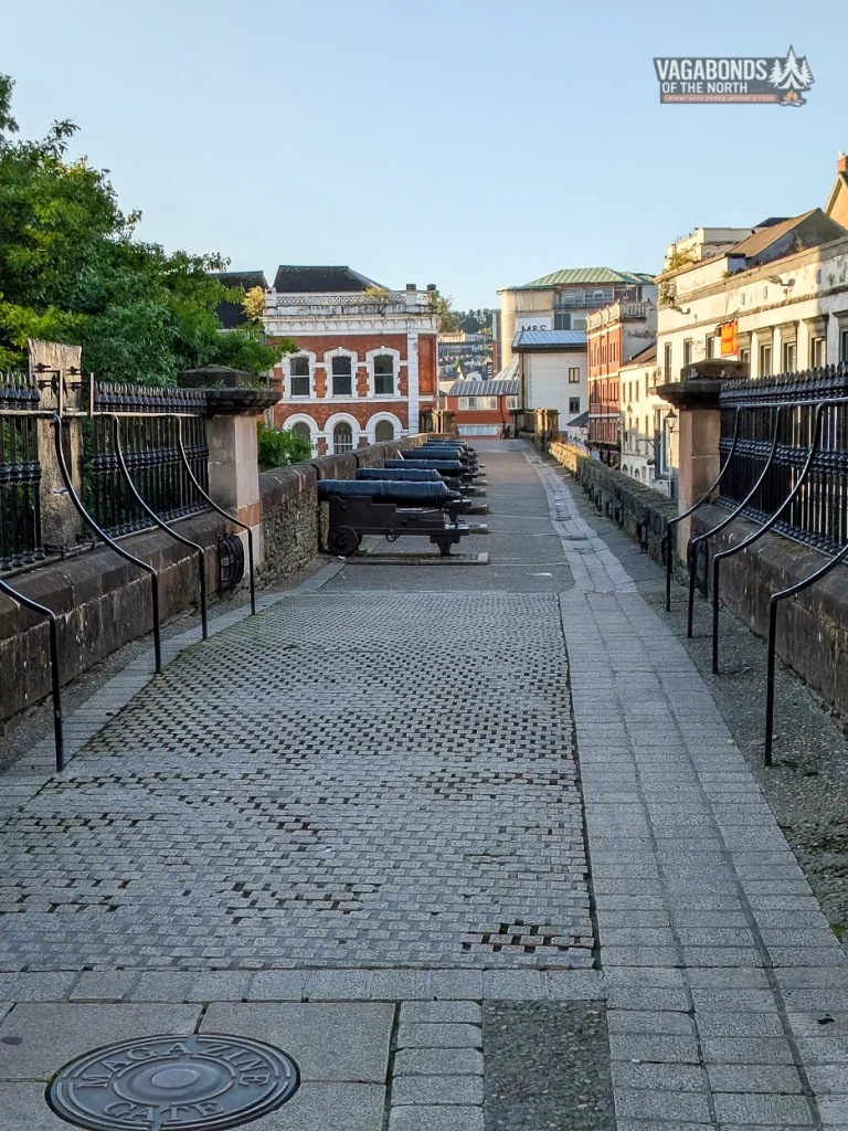
Magazine Gate and cannons that really did speak
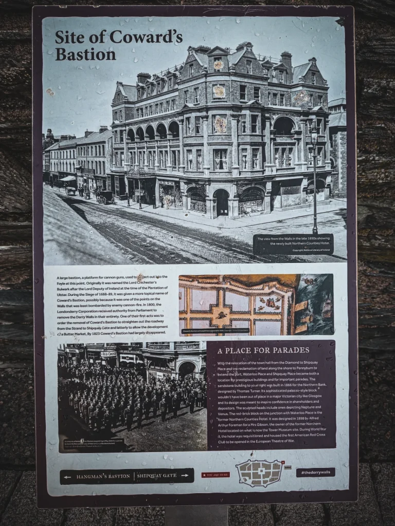
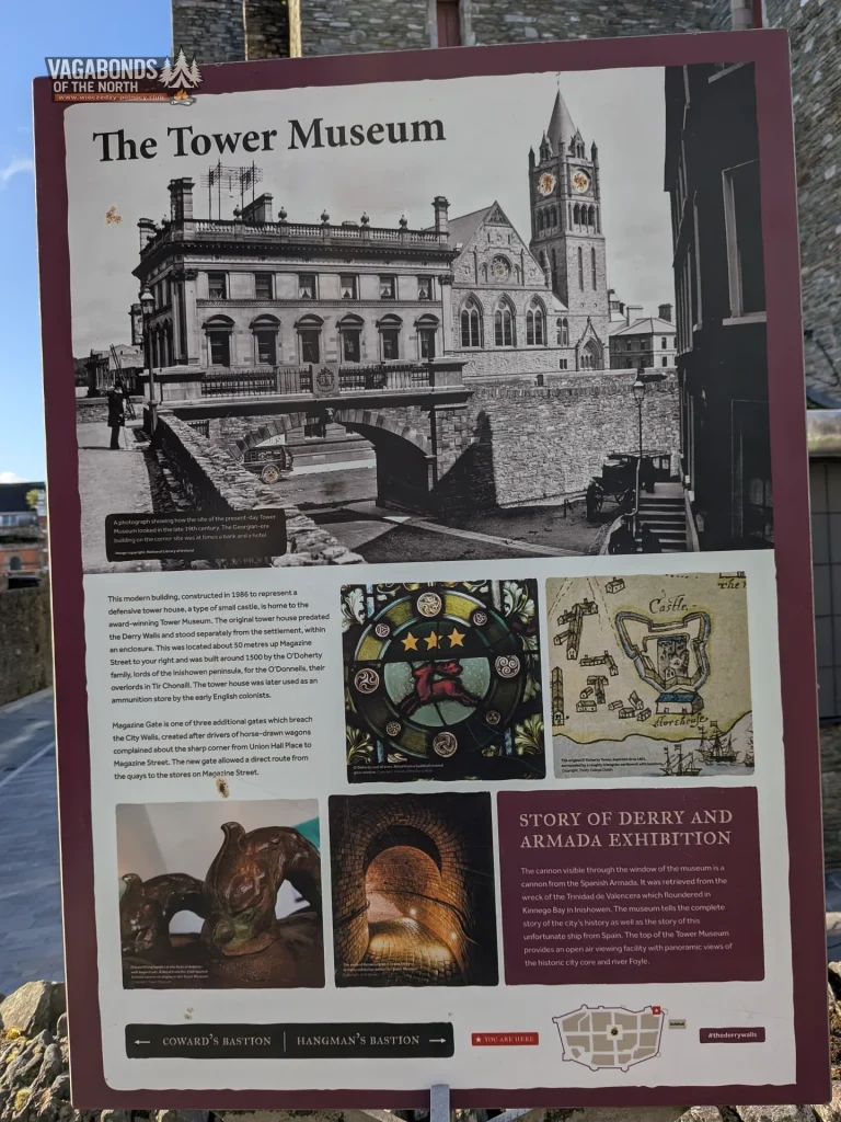
Magazine Gate soon appears along the route. It is the youngest of Derry’s seven gates.
It was opened around 1888 after drivers of horse-drawn carts complained about the awkward sharp turn on the route towards the stores on Magazine Street. The new opening provided a much more direct connection between the quays and the interior of the city.
The gate itself is relatively recent, but this area has a much older history. Before the walls were built, a fortified tower house belonging to the O’Doherty family of Inishowen stood nearby. After Derry was taken over by the English colonists, the site was used, among other purposes, for storing ammunition.
The modern Tower Museum deliberately echoes the appearance of that earlier defensive tower.
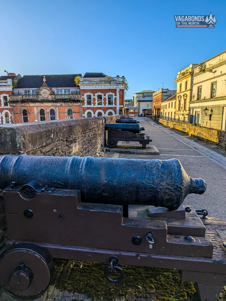
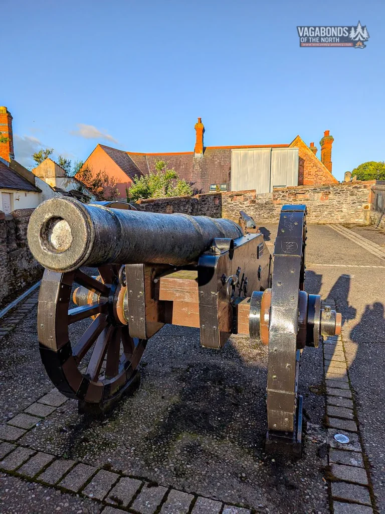
Along the northern and western sections of the walls stands a collection of historic cannons. These are not decorative replicas placed here later simply to make the walk more interesting. Many of them genuinely defended the city during the 17th-century sieges.
Derry is home to one of Europe’s most important collections of cannon with documented histories. In 2005, 24 surviving guns were cleaned, conserved and mounted on reconstructed carriages.
When the fate of the city was being decided, these cannons were anything but silent. Their reports echoed from the hills across the valley, while each artillery position covered its own field of fire.
Walking between them today, it is easy to forget that more than three centuries ago the landscape beyond the wall was not a panorama for photographs. It was a battlefield.
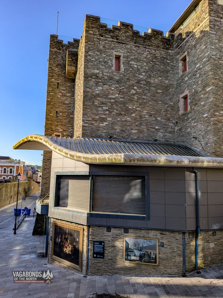
Tower Museum — a tower that only looks ancient
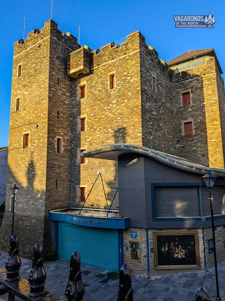
Tower Museum can be deceptive. Its massive form looks as though it ought to be another surviving part of the old fortifications.
In fact, the modern building was deliberately designed to evoke the fortified O’Doherty tower house that once stood in this area. The museum tells the story of Derry from its earliest history through to modern times.
Another major part of its collection concerns La Trinidad Valencera, one of the ships of the Spanish Armada. The vessel sank in 1588 in Kinnagoe Bay on the Inishowen Peninsula.
Through the museum window, a cannon recovered from the wreck can be seen — an object older than Derry’s city walls themselves.
At the beginning of my walk, Tower Museum was one of the first landmarks I passed. It would appear again at the end, providing the best possible proof that the circuit had genuinely been completed.
PART 3 — THE GATES FACING THE FOYLE
Shipquay Gate — from the river to the heart of the city
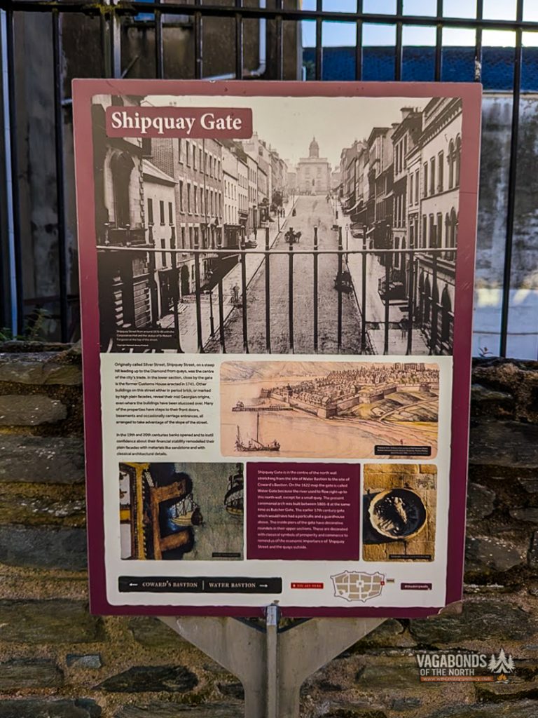
Shipquay Gate was one of the four original entrances to Derry. It provided access to the city from the quays and the River Foyle.
The present arch dates from 1805 and replaced an earlier, much more defensive structure equipped with a tower and portcullis.
From the gate, Shipquay Street climbs towards the Diamond. The view gives an excellent sense of the planned layout of the 17th-century city: a central square, straight streets and gates positioned at the ends of its principal axes.
This was not a settlement that had simply grown at random over centuries. The city within the walls was intended to be orderly, controllable and defensible.
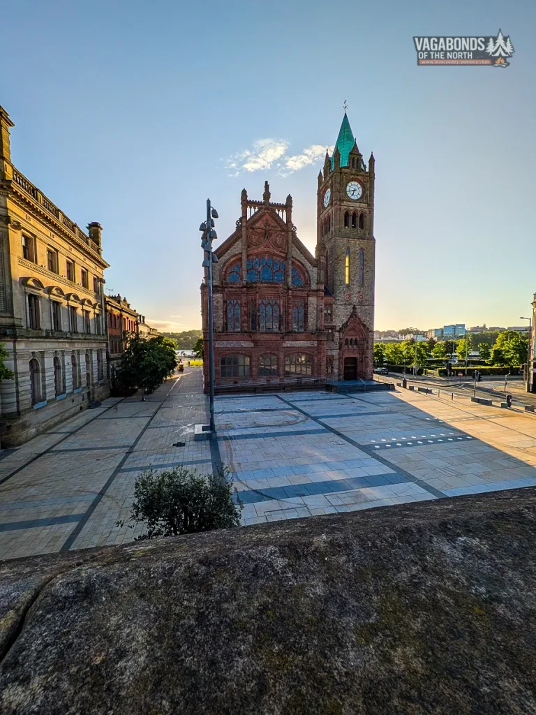
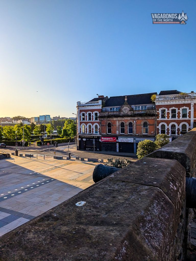
Outside the walls, the view opens towards Guildhall, the waterfront and the Foyle.
In the 17th century the river was both a supply route and a possible avenue of attack. During the Siege of 1689, it was also the route by which desperately needed relief would eventually have to reach the starving city.
Thirteen young men close the gates
To understand the significance of the next section, we need to return to December 1688.
The Glorious Revolution was unfolding in England. The Catholic King James II was losing his throne to the Protestant William of Orange and Mary. Ireland would become one of the principal battlegrounds between Jacobites loyal to James and supporters of William.
A force commanded by Alexander MacDonnell, Earl of Antrim, was approaching Derry. The city authorities hesitated over whether to admit the soldiers.
On 7 December 1688, thirteen young apprentice boys made the decision for them. They shut the gates — according to tradition, Ferryquay Gate in particular — and refused to allow the troops into the city.
That action did not end the crisis. It began it.
A few months later James II’s army stood outside Derry, and the refusal to surrender turned the city into one of the major strongholds of the Williamite War in Ireland.
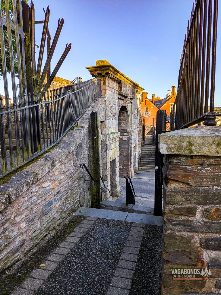
Ferryquay Gate, which carried the old road towards the crossing of the Foyle, originally had a tower and drawbridge. Its present form dates from 1865. The façade carries representations of two clergymen associated with the city’s history: George Walker and James Gordon.
INFOBOX — The four original gates
Shipquay Gate, Ferryquay Gate, Bishop’s Gate and Butcher Gate. New Gate, Castle Gate and Magazine Gate were added later.
New Gate Bastion — a city on both sides of the wall
New Gate was not part of the original system.
An opening had previously existed here towards Wapping Lane, now Fountain Street. It was strengthened and developed into a proper gate during the unsettled atmosphere of the 1790s, shortly before the United Irishmen’s Rebellion of 1798.
From the bastion it becomes clear that the walls did not only divide physical space. Over time, they also came to mark social, religious and political boundaries.
On one side remained the historic centre of the plantation city. Beyond the walls developed communities with different histories and identities.
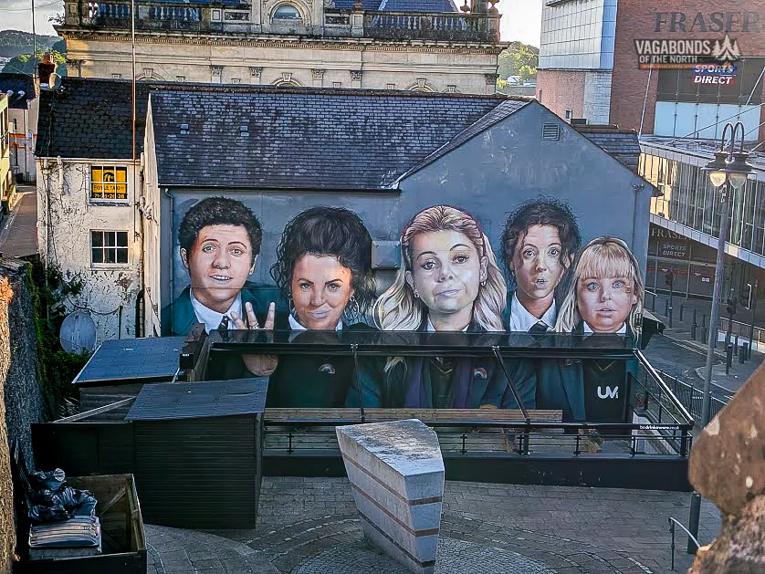
The modern city appears in the panorama too, including the Derry Girls mural — a cheerful piece of pop culture standing within sight of places associated with wars, sieges and conflict.
Derry refuses to belong to a single century.
PART 4 — A CITY BUILT FOR DEFENCE
Artillery Bastion and the weight of defence
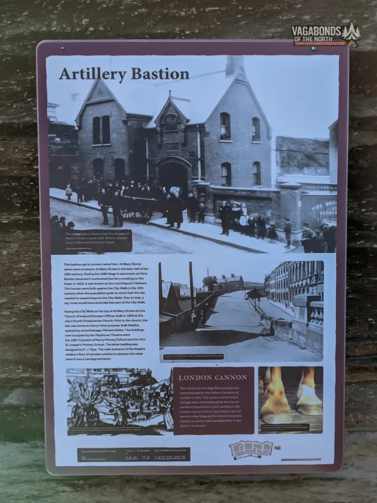
The next section leads towards Artillery Bastion, formerly known as Ferry Bastion.
Its enlarged platform allowed guns to be positioned to control approaches to the walls and the area around the river crossing. Here, the sheer width of the fortifications is more impressive than the stone façade seen from street level.
Derry’s walls were built in the age of artillery. The earth rampart behind the stone facing absorbed impacts more effectively than a thin wall of solid masonry.
The bastions projected beyond the line of the walls so defenders could fire along neighbouring sections, reducing areas that attackers could approach without being exposed.
During the Siege of 1689, cannon and small arms were enormously important. Yet in the end, the greatest enemies of the people inside the city were not projectiles.
They were hunger, disease and overcrowding in a city swollen by refugees from the surrounding countryside.
Church Wall — a cathedral in the shadow of the guns
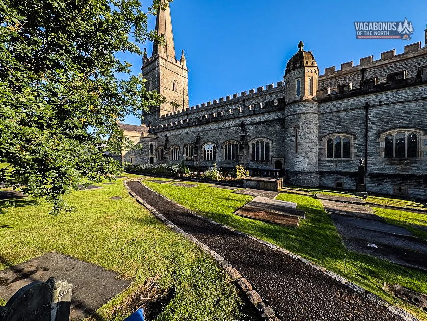
Along the section known as Church Wall, St Columb’s Cathedral rises above the surrounding buildings.
The cathedral was built during the first half of the 17th century and consecrated in 1633. It became one of the most important buildings in the new city and was the first Anglican cathedral constructed in the British Isles after the Reformation.
During the siege, it was far more than a place of worship. Its tower served as an observation point, while the cathedral became a focus of life for the community trapped within the walls.
Local tradition holds that lead from its roof was used to make bullets. Inside are numerous relics associated with the siege, including documents, flags and the famous Bomb Font, made from a mortar shell.
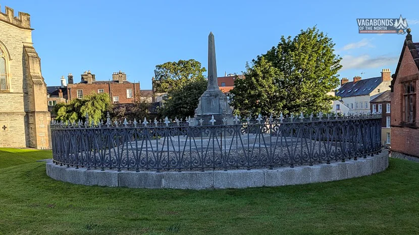
Beside the cathedral lies Siege Heroes Mound, another place connected with the memory of Derry’s defenders.
This entire section of the walls brings together the military and religious faces of the city. Cannons stand only a short distance from the church, while the cathedral tower rises above the old defensive positions.
Small watchtowers and traces of passages also survive along the wall, reminders of the need to move quickly between the interior of the city and its defensive positions.
They are easy details to overlook, but they help turn the fortifications from a picturesque stone walkway back into a working defensive system.
PART 5 — THE BESIEGED CITY
105 days without surrender
In April 1689, James II himself appeared outside the walls and called on the city to surrender.
The answer from Derry was refusal.
The siege that followed lasted 105 days.
The Jacobites attempted bombardment and attacks but failed to break through the fortifications. They therefore changed tactics. If the city could not be taken by force, it could be starved into submission.
Normal food supplies quickly disappeared. Prices soared, rations shrank and the inhabitants resorted to eating whatever could be found.
Disease spread through the overcrowded city as efficiently as artillery fire. Thousands died.
The situation was further complicated by a dispute over leadership. Governor Robert Lundy believed the defence to be hopeless and was accused of preparing to surrender the city. He eventually escaped in disguise.
To the Apprentice Boys, Lundy remains a symbol of betrayal, and an effigy of him is burned during the December commemorations of the closing of the gates.
The defence was led by figures including the clergyman George Walker, Major Henry Baker, Adam Murray and John Mitchelburne. Their decisions, the memory that developed around them and the ways in which they were later commemorated became part of the city’s Protestant tradition.
Relief forces were on the Foyle, but access to Derry was blocked by a boom stretched across the river and by Jacobite batteries.
On 28 July, the Mountjoy, supported by the Phoenix and the frigate HMS Dartmouth, broke through the boom.
Food finally reached the city.
On 1 August, the defenders discovered that the besieging army had withdrawn.
The words No Surrender survived far longer than the siege itself. They became part of unionist identity and tradition.
It is impossible to tell the story of Derry’s walls while pretending that the memory of 1689 is simply a closed chapter in a history book. It remains visible in parades, organisations, names, monuments and continuing debates about how the past should be remembered.
TIMELINE
- 7 December 1688 — thirteen apprentice boys close the gates,
- 18 April 1689 — beginning of the main siege,
- 28 July 1689 — Mountjoy breaks through the boom on the Foyle,
- 1 August 1689 — withdrawal of the Jacobite army discovered and siege ends.
PART 6 — GATES, PRISON AND ROARING MEG
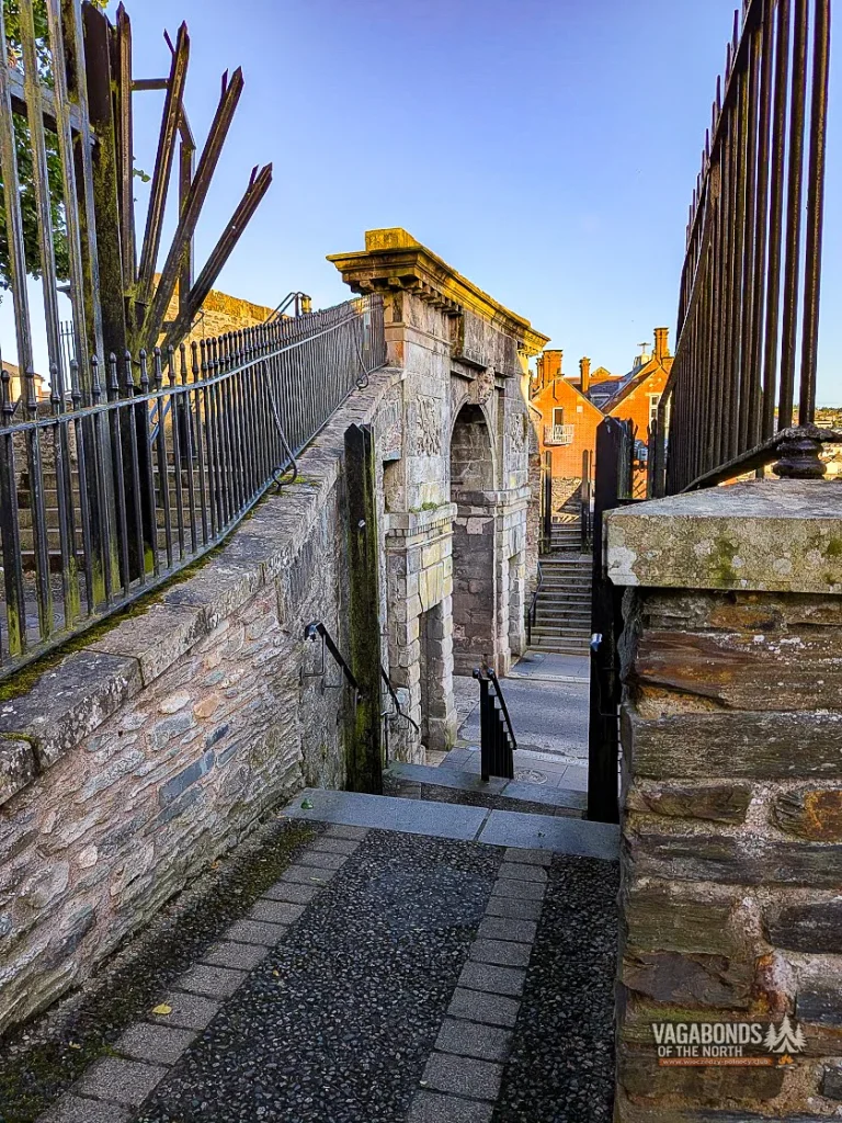
Bishop’s Gate — a triumphal arch instead of a defensive gate
Bishop’s Gate was one of the four original entrances to the city, although the structure we see today did not witness the siege.
In 1789, on the centenary of the events, the old defensive gate was replaced by a ceremonial triumphal arch designed by H.A. Baker.
Carved heads on either side symbolise the rivers Foyle and Boyne.
The pairing is deliberate. The Foyle saved Derry when the relief ships broke through the boom. The Boyne recalls the battle of 1690, when William of Orange defeated James II and helped determine the outcome of the war.
Looking at the peaceful classical arch today, it is easy to forget that its predecessor formed part of a system designed to be closed, barricaded and defended.
The present structure no longer protects the city. Instead, it tells us how later generations chose to remember its victory.
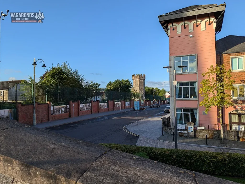
The old prison tower
Near Bishop’s Gate stands the massive stone tower of the former prison.
It is one of those structures that can easily be mistaken at first glance for part of the older fortifications. Instead, it belongs to a later chapter in the life of the city within the walls.
Derry did not stop in 1689. During the centuries that followed, new institutions, streets and public buildings continued to appear inside the old defensive ring.
The prison tower’s severe stone form fits naturally beside the walls, but it tells a different story — not of defending the city against an army outside, but of controlling people already inside it.
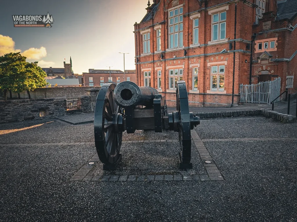
Double Bastion and Roaring Meg
Waiting on Double Bastion is Derry’s most famous cannon: Roaring Meg.
Cast in 1642, it was presented to the city by London’s Fishmongers’ Company. Its name came from the tremendous noise it produced — a roar said to have lifted the spirits of the defenders while making an equally strong impression on their opponents.
Roaring Meg weighs around 1.8 tonnes.
She is certainly a formidable lady, but not a four-tonne one. In her case, as in so many others, legend appears to have added a little extra weight.
The gun fired 18-pound shot and took part in the defence of Derry during the siege.
Double Bastion occupied a particularly important position. The hills beyond Bogside gave the Jacobites places from which to establish batteries against the western defences.
The heaviest bombardment was directed at the section between Butcher Gate and Double Bastion. The walls and gate were badly damaged, but they did not collapse.
Today this is one of the finest viewpoints on the entire circuit.
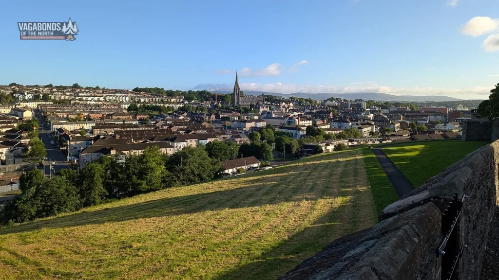
The barrel of Roaring Meg points across Bogside towards St Eugene’s Cathedral, Creggan and the hills beyond.
Within a single frame, two of Derry’s great historical narratives meet: the 17th-century siege and the much later story of the community that developed outside the walls.
We will not tell that second story here.
Later that same morning, after completing the circuit, I walked down into Bogside and followed the route associated with Bloody Sunday.
That is another walk — and another story.
PART 7 — A SYMBOL THAT IS NO LONGER THERE
Royal Bastion and the monument that disappeared
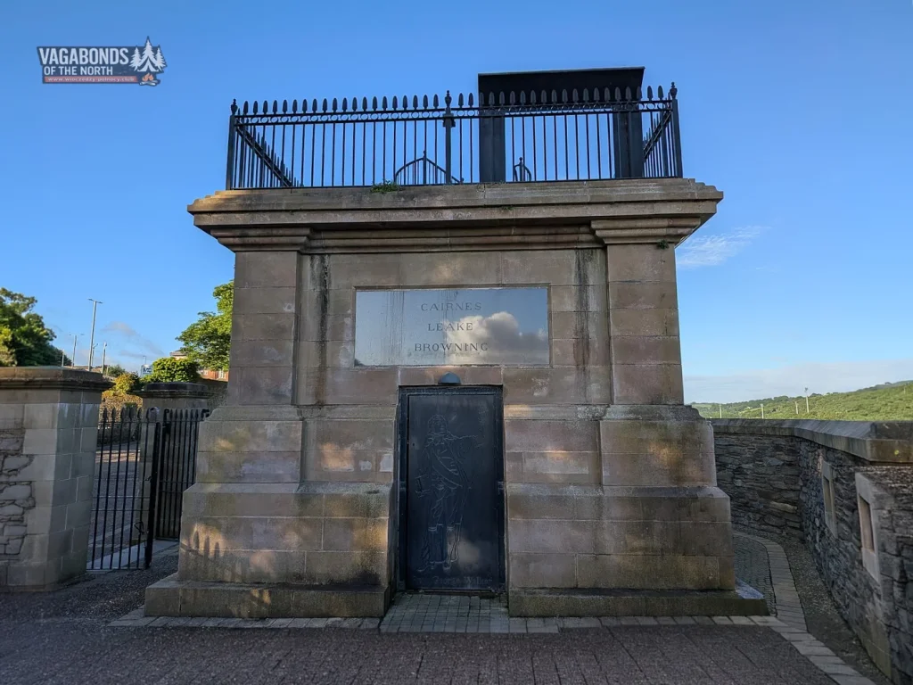
Today an empty pedestal known as Walker’s Plinth stands on Royal Bastion.
Between 1826 and 1828, a tall column topped by a statue of the Reverend George Walker, one of the leaders of Derry’s defence, was erected here.
The monument towered over the city and could be seen from a considerable distance.
In 1973, the column was destroyed by a bomb.
The surviving plinth became another layer of history in its own right. It does not only recall the Siege of Derry. It also demonstrates how symbols inherited from the past became entangled in a much later conflict.
During our visit, however, the door into the plinth was closed, and there was nothing to suggest that access was regularly available.
So we will not promise visitors an experience we could not verify ourselves.
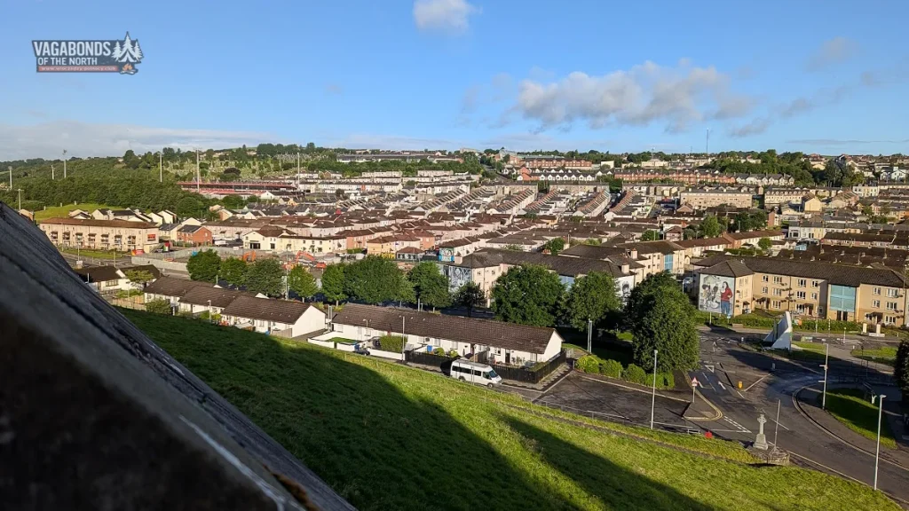
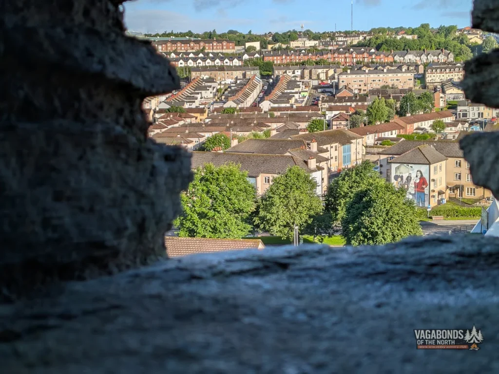
Even from the level of the walls, the position of historic Derry is easy to understand: a hill surrounded by lower ground, the river providing a route towards the outside world, and the western approaches from which the city came under fire.
It is a panorama that doubles as a map of several centuries.
PART 8 — A CHURCH AND FOURTEEN TREES
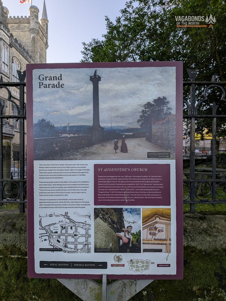
St Augustine’s — a small church on a very old site
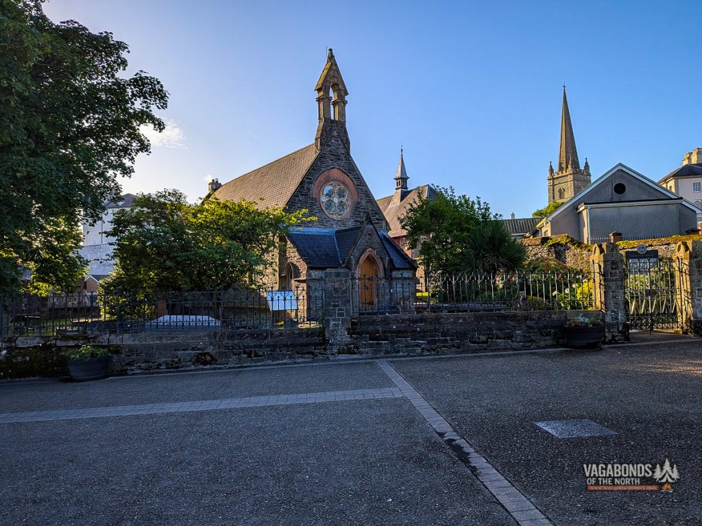
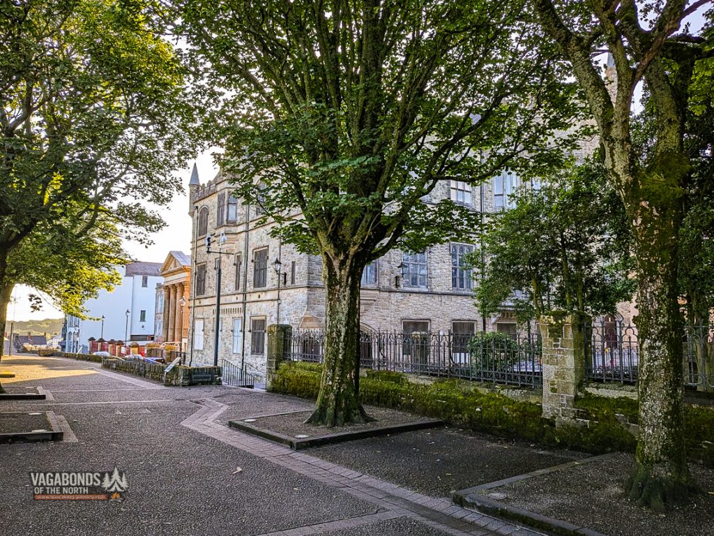
Close to Grand Parade stands the small church of St Augustine’s.
In size it cannot compete with St Columb’s Cathedral, but it occupies a site associated with Derry’s earliest Christian history and the tradition of St Columba’s monastery.
The present church dates from the 19th century, although local memory reaches much further back.
Its surrounding graveyard and quiet green setting create a striking contrast with the cannons positioned on the nearby walls.
In Derry, places of worship, burial and warfare often stand almost side by side.
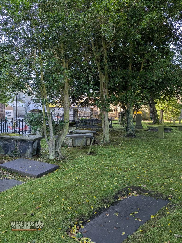
St. Augustine’s—a small church on a very old site
Close to Grand Parade stands the small church of St Augustine’s.
In size it cannot compete with St Columb’s Cathedral, but it occupies a site associated with Derry’s earliest Christian history and the tradition of St Columba’s monastery.
The present church dates from the 19th century, although local memory reaches much further back.
Its surrounding graveyard and quiet green setting create a striking contrast with the cannons positioned on the nearby walls.
In Derry, places of worship, burial, and warfare often stand almost side by side.
PART 9 — REMEMBERING THE SIEGE
Apprentice Boys and the memory of 1689
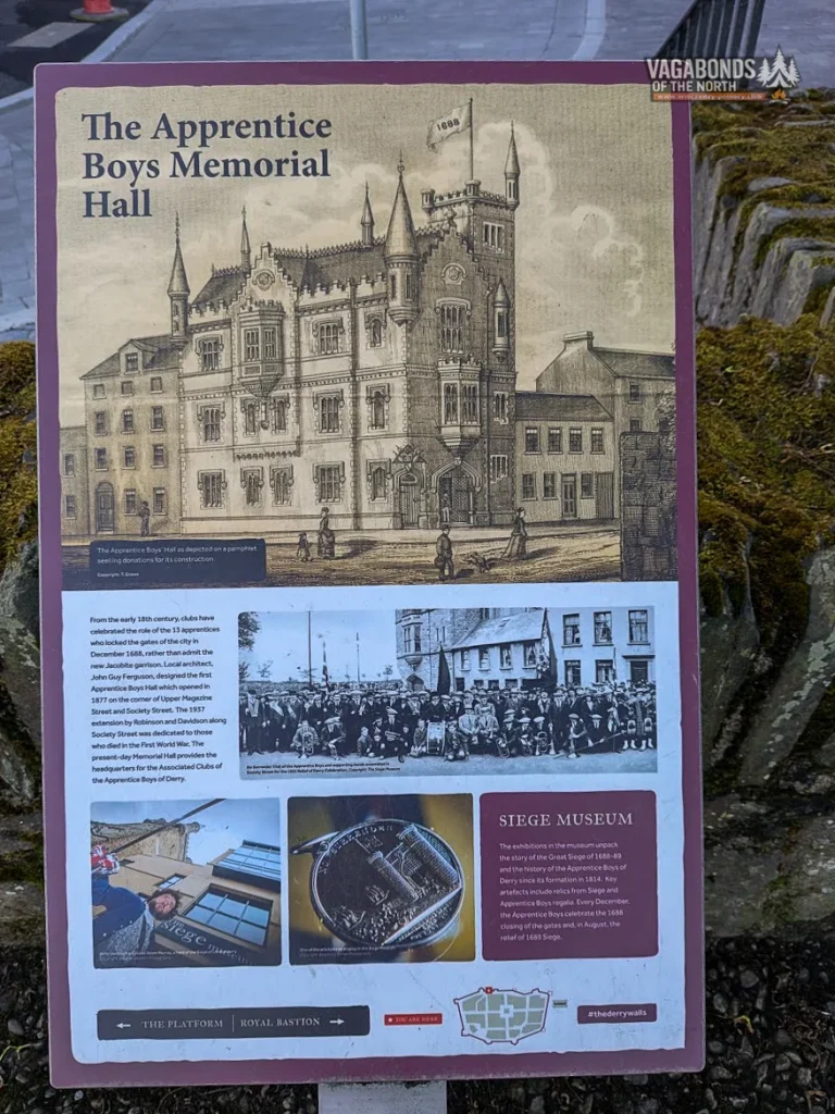
From the walls, the Memorial Hall of the Apprentice Boys of Derry can be seen.
The organisation takes its name from the thirteen young men who closed the gates in 1688. It continues to preserve the memory of the siege and organises the two principal annual commemorations: the Shutting of the Gates in December and the Relief of Derry in August.
Nearby, the Siege Museum displays objects connected with the siege, the history of the Apprentice Boys and Protestant fraternal organisations.
For a visitor, these places demonstrate that 1689 is not simply something confined to Derry’s museums.
It remains part of a living identity.
That memory is not neutral, nor did it develop in isolation.
For some, the story of Derry represents religious liberty, resistance and survival. For others, the walls and the traditions surrounding them evoke plantation, inequality and the historical dominance of one community.
Understanding Derry means recognising both perspectives.
But they cannot be squeezed honestly into a single paragraph in a walk around the walls.
That is why Bogside and Bloody Sunday will have a story of their own.
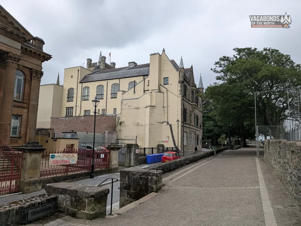
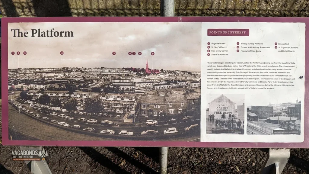
The Platform — above the rooftops of Bogside
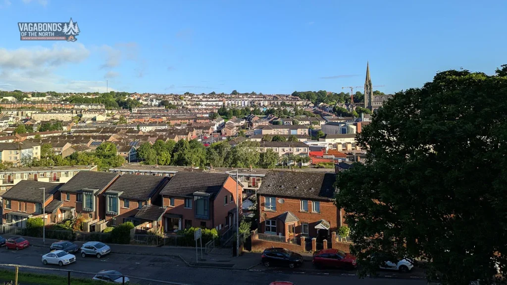
The Platform opens onto a broad view across the western side of the city.
In the morning light, the red roofs of the houses, the slopes of Creggan and the tall spire of the Catholic St Eugene’s Cathedral can all be seen.
Below lies Bogside.
During the siege, the western hills offered natural positions for artillery firing against the city.
In later centuries, the same landscape became home to a community whose history developed in the shadow of the walls — both literally and symbolically.
For now, however, we remain above it.
The panorama serves as a preview of the second part of the morning, not as a shortcut through the entire history of the Troubles.
From the walls, we can see the places we are about to visit.
Only once we reach street level, however, do their layout and significance become fully clear.
PART 10 — THE GATES FACING BOGSIDE
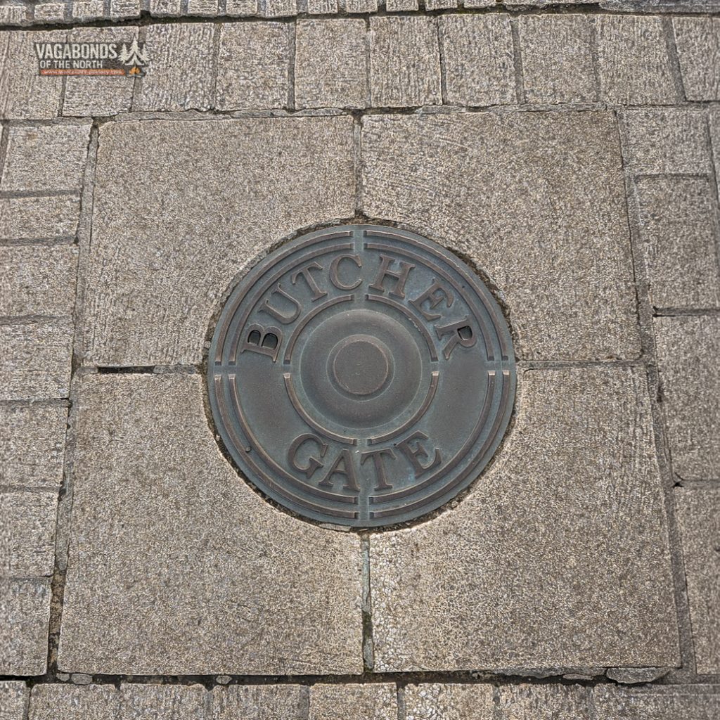
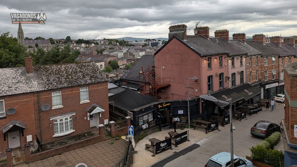
Butcher Gate — the gate that took the heaviest fire
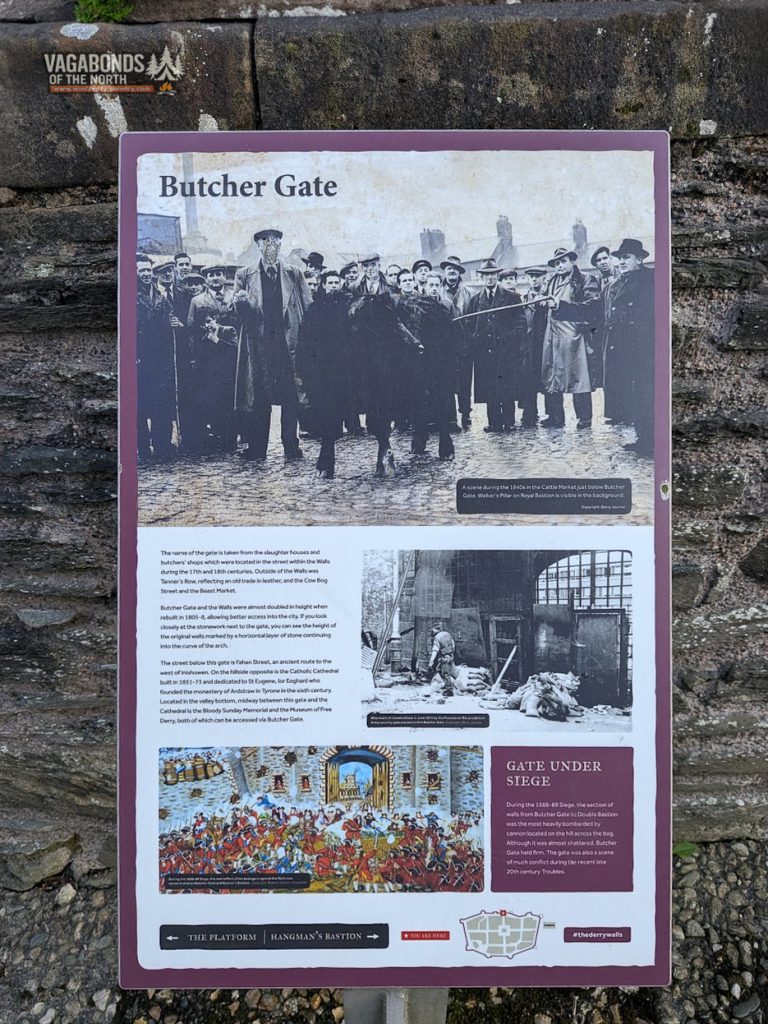
The name Butcher Gate comes from the slaughterhouses and meat shops that once operated along the street inside the walls.
Outside the gate were places connected with other stages of the same trade: tanneries, a cattle market and areas where animals were kept.
During the siege, the section between Butcher Gate and Double Bastion was the most heavily bombarded part of Derry’s defences.
Jacobite guns positioned on the hills beyond the marshy valley came close to smashing the gate, but the defenders held their position.
The structure we see today is the result of later alterations.
At the beginning of the 19th century, the gate and adjoining walls were raised and adapted to accommodate increasing traffic.
The earlier level of the fortification can still be read in the stonework: the horizontal line of the former wall continues into the curve of the arch.
Below runs Fahan Street, once the road leading west towards Inishowen.
Today Butcher Gate is also one of the main passages between the historic city centre and Bogside, the Museum of Free Derry and the Bloody Sunday Monument.
It is another gate that connects different periods of Derry’s history far more effectively than it separates them.
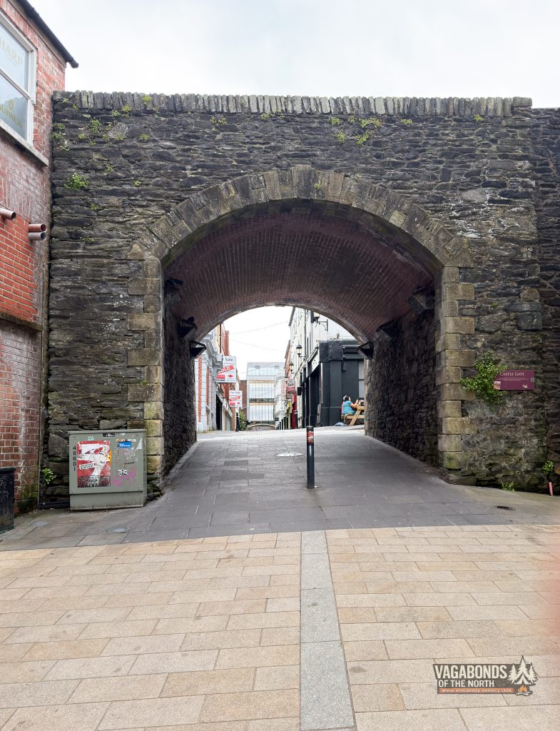
Castle Gate — the city grows beyond its fortifications
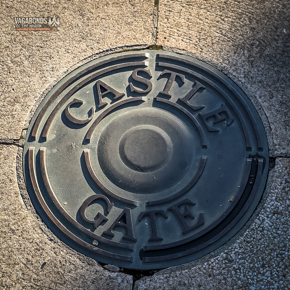
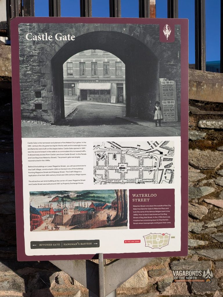
Castle Gate is the narrowest and simplest of Derry’s gates.
It did not exist during the siege.
It was opened in 1803, by which time Derry had long since outgrown the comfortable limits of its 17th-century defensive ring.
Houses, workshops and factories were spreading down the slopes outside the walls, and additional entrances had become necessary.
The gate improved the connection between Castle Lane, now Castle Street, and the area around Parade and Cow Bog, today known as Waterloo Street.
The present appearance of Castle Gate is largely the result of reconstruction carried out during the 1990s.
Nearby is the entrance to Craft Village, a modern development designed in the style of Irish buildings from the 18th and 19th centuries.
It is a useful example of the way Derry fills the space between authentic historic fabric and later interpretations of the historic city.
PART 11 — CLOSING THE CIRCUIT
Hangman’s Bastion and the final stretch
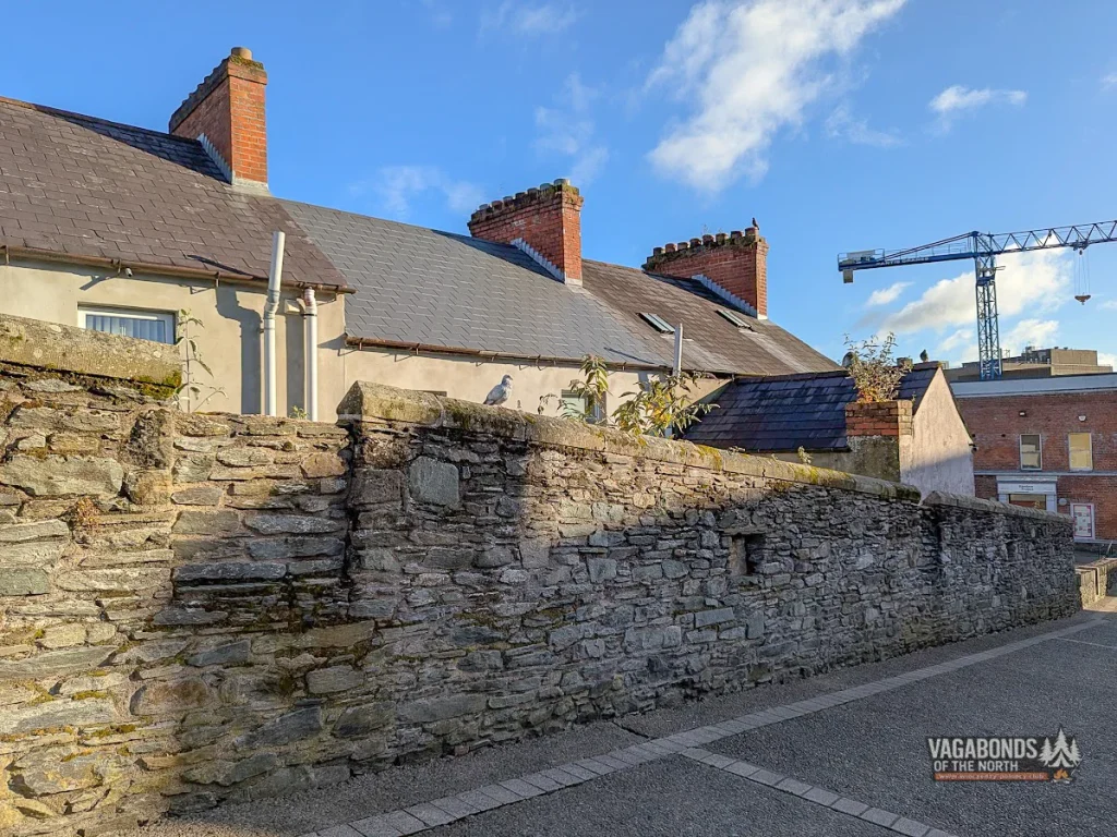
Beyond Castle Gate, the route continues towards Hangman’s Bastion.
The name promises a dark story, but on that particular morning the section itself was peaceful: a stone promenade, the rear elevations of buildings, a few birds and the modern city slowly waking below.
Places like this are where the continuity of the walls becomes most apparent.
The major gates and bastions naturally attract attention, but a complete circuit also consists of quieter, less spectacular stretches linking them together.
Without those sections, there would be no sense of a closed defensive ring.
Back to Tower Museum
After just under 48 minutes, Tower Museum appeared in front of me again.
At the beginning of the walk, it had been a sign of what lay ahead.
Now it marked the end of the circuit.
The final photograph was taken at 6:28:45.
The city was still quiet, although the light had already changed.
Behind me were the four original gates, three later openings, a succession of bastions, churches, an old prison, monuments and a line of cannons from an age when nobody climbed onto these walls simply to admire the view.
The complete circuit is not long.
You can walk it quickly and treat it as an enjoyable route above the rooftops of Derry.
Or you can stop every few dozen metres and discover that a mile of stone walls is enough to tell four centuries of the city’s history.
I chose the second option.
And this was only the first walk of that Sunday morning.
PART 12 — THE WALK CAPTURED ON FILM
Forty-eight minutes of an early-morning walk condensed into a few minutes of film — a complete circuit of Derry City Walls, from the first stone steps to the return to Tower Museum.
From the walls, we looked down on Bogside. A few minutes later we walked down into it, beginning the second part of our morning — following the story of Bloody Sunday.
PRACTICAL INFORMATION
Derry City Walls
- Route length: approximately 1.5 km / 1 mile.
- Walking time: approximately 30–45 minutes for the circuit itself; allow at least an hour if you want to take photographs and read the interpretation panels.
- Admission: free.
- Access points: steps and ramps are available at several gates and streets around the old city.
- Surface: mainly a broad stone promenade, with steps, slopes and some uneven sections.
- Best time for quiet photography: early morning, before tour groups arrive.
- Main views: the old city, Guildhall, River Foyle, Bogside, Creggan, St Columb’s Cathedral and St Eugene’s Cathedral.
- Nearby: Tower Museum, Siege Museum, St Columb’s Cathedral, Guildhall, Craft Village and Bogside.
Discover with us: